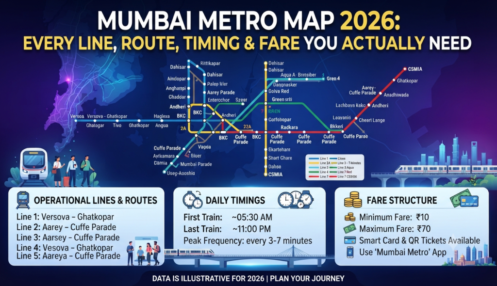
If you commute across Mumbai or are house-hunting near a station, the Mumbai Metro map 2026 looks very different from just two years ago. With Line 3 (the underground Aqua Line) now running end to end and four corridors fully operational, the network finally stitches the western suburbs, the eastern belt and the island city together. This guide breaks down every operational line, its route, timings and fares so you can plan a journey or judge a locality without guesswork.
Which Mumbai Metro lines are operational in 2026?
As of 2026, four Metro corridors are fully open to the public. The rest of the 337-km master plan (Lines 2B, 4, 4A, 5, 6, 7A, 9 and 12) is still under construction, with most sections expected between 2026 and 2027. Here is the current operational network at a glance.
| Line | Colour | Route | Stations | Length |
|---|---|---|---|---|
| Line 1 | Blue | Versova – Ghatkopar | 12 | 11.4 km |
| Line 2A | Yellow | Dahisar East – Andheri West (DN Nagar) | 17 | 18.6 km |
| Line 3 | Aqua | Aarey JVLR – Cuffe Parade | 27 | 33.5 km |
| Line 7 | Red | Dahisar East – Gundavali (Andheri East) | 14 | 16.5 km |
Lines 2A and 7 run as a continuous elevated corridor along the Western Express Highway, so a single ride lets you loop from Dahisar down to Andheri on either the east or west side of the highway. This multi-line integration mirrors what other Indian metros such as Hyderabad have achieved with interchange hubs.
Mumbai Metro route map with stations: line by line
Line 1 (Blue) — Versova to Ghatkopar
The oldest line, open since 2014, is the fastest east-west link across the suburbs. It connects Versova, Andheri (interchange with the Western Railway and Line 7), Marol, Saki Naka and Ghatkopar (interchange with the Central Railway). A trip that once took an hour by road now takes about 20 minutes.
Line 2A (Yellow) and Line 7 (Red)
These two lines form a horseshoe around the western suburbs. Line 2A runs on the west of the Western Express Highway from Dahisar East to DN Nagar in Andheri West, while Line 7 runs on the east from Dahisar East to Gundavali. Together they serve Borivali, Kandivali, Malad, Goregaon and Andheri commuters who previously depended entirely on the crowded Western Railway.
Line 3 (Aqua) — the game changer
Mumbai’s first fully underground line became operational end to end in October 2025. Running 33.5 km from Aarey JVLR to Cuffe Parade with 27 stations, it directly links the western suburbs to the Bandra-Kurla Complex, the airport (both terminals), Worli, and the business district of Nariman Point and Cuffe Parade in south Mumbai.
Mumbai Metro Line 3 timings and stations
Line 3 operates from 6:00 AM to 10:00 PM, with trains every 7–8 minutes during peak hours and 10–12 minutes off-peak. Because it is underground, it is unaffected by monsoon flooding that regularly disrupts road and local-train traffic. Key stations include Aarey JVLR, SEEPZ, MIDC, Marol Naka (interchange with Line 1), CSMIA Airport T1 and T2, Bandra Colony, BKC, Dharavi, Worli, Mumbai Central, Grant Road, CSMT and Cuffe Parade. The line connects to the suburban railway at Santacruz, Dadar, Mahalaxmi (also the monorail), Grant Road, CSMT and Churchgate, making it the true spine of the 2026 network.
Mumbai Metro fare chart 2026
Fares are distance-based and among the most affordable in the city. Line 1 charges between ₹10 and ₹40. Line 3 uses a tiered structure shown below; Lines 2A and 7 follow a comparable slab.
| Distance | Line 3 fare |
|---|---|
| Up to 2 km | ₹10 |
| 2–5 km | ₹20 |
| 5–12 km | ₹30 |
| 12–18 km | ₹40 |
| 18–24 km | ₹50 |
You can pay with a contactless smart card, a QR ticket bought at the station or through the official metro app. Fares are revised periodically, so verify the latest slab on the MMRDA or Maha Mumbai Metro portal before a long trip.
How to find the nearest Mumbai Metro station to your area
The quickest way is to open Google Maps, search your locality and filter for “metro station,” or use the station locator on the official metro operator’s website. As a rule of thumb for 2026:
- Western suburbs (Borivali–Andheri): Lines 2A and 7 along the Western Express Highway.
- Andheri–Ghatkopar belt: Line 1.
- BKC, airport, Worli, south Mumbai: Line 3.
Metro proximity has become a genuine price driver. Buyers increasingly shortlist homes within walking distance of a station, which is why it pays to check connectivity before you shortlist. If you are exploring the market, browse verified Godrej projects in Mumbai and compare 2 BHK flats in Mumbai by their distance to the nearest line.
Why the metro matters for homebuyers in 2026
A station within a kilometre can shave 30–45 minutes off a daily commute and typically supports stronger rental demand and resale value. When you evaluate a project, look beyond the brochure distance and check walking access, the line’s direction of travel toward your workplace, and future extensions that may add stations nearby. If you are weighing options across the region, adjoining markets like Navi Mumbai are building their own metro network too, so factor in where each city’s connectivity is headed. And when comparing two homes, remember that a ready project near an operational line often beats a distant one on total cost of ownership — a trade-off we cover in our guide on under-construction vs ready-to-move flats.
Frequently Asked Questions
How many Mumbai Metro lines are operational in 2026?
What are the Mumbai Metro Line 3 timings?
What is the minimum and maximum Mumbai Metro fare?
Does the Mumbai Metro connect to the airport?
How do I find the nearest metro station to my area?
This article is for general information only. Metro routes, timings and fares change as new sections open — verify current figures on the official MMRDA or Maha Mumbai Metro portal before you travel. Godrej Realty Homes is a property listings portal.