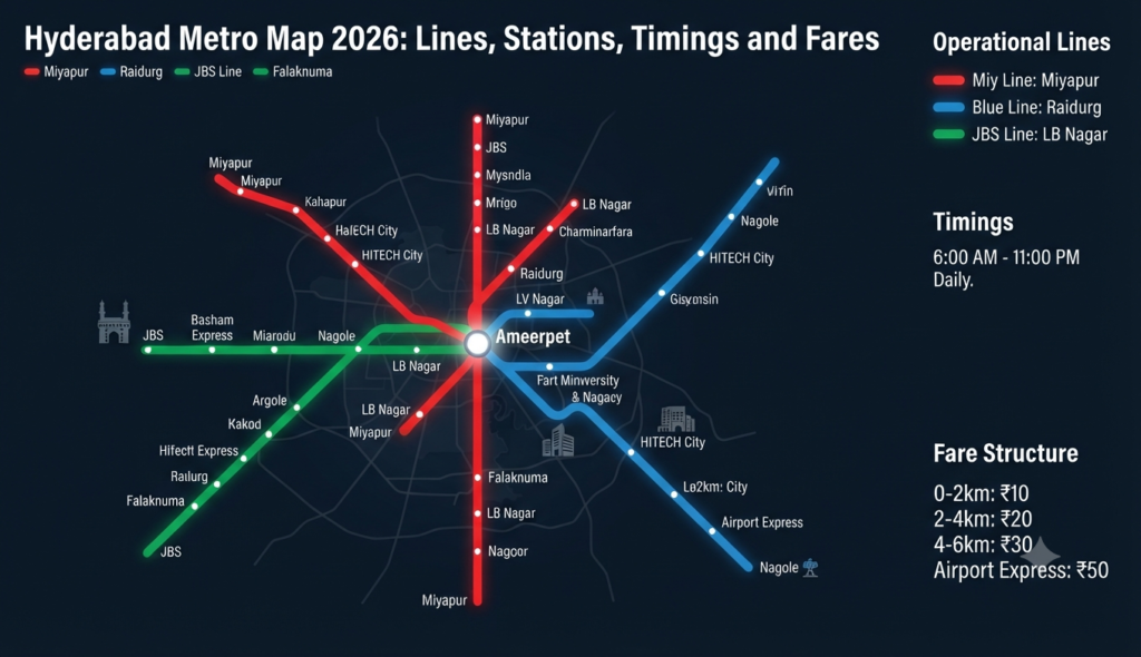
Hyderabad’s rapid transit has become the backbone of daily travel across the city, and the Hyderabad metro map 2026 is the first thing many commuters and homebuyers check before choosing a route or a locality. With three colour-coded corridors covering nearly 69 km and a major Phase 2 expansion on the way, knowing the lines, stations, timings and fares makes getting around — or investing near a station — far easier. Here is the complete, up-to-date picture.
Hyderabad Metro lines and route map 2026
Hyderabad Metro currently runs three operational lines, all interchanging at central hubs so you can cross the city with a single transfer. The network is one of the largest privately built metro systems in India.
| Line | Route | Stations | Length |
|---|---|---|---|
| Red Line (1) | Miyapur – LB Nagar | 27 | 29.2 km |
| Green Line (2) | JBS Parade Ground – MGBS | 9 | ~11 km |
| Blue Line (3) | Nagole – Raidurg | 23 | 27 km |
The Red and Blue lines interchange at Ameerpet, the busiest hub in the system, while the Green Line connects at Parade Ground and MGBS. This means you can travel from IT hubs like Raidurg and HITEC City in the west all the way to LB Nagar in the south-east with one change at Ameerpet.
Hyderabad Metro route and timings
All three lines run on a broadly similar schedule. Trains begin around 6:00 AM from the terminals and the last services depart by 11:00 PM on the Red and Blue lines (about 11:35 PM on the Green Line). Frequency is roughly every 5–7 minutes during peak hours and 10–15 minutes off-peak.
Red Line (Miyapur – LB Nagar)
The longest corridor cuts across the city through Kukatpally, Ameerpet, Punjagutta, Secunderabad and Malakpet before ending at LB Nagar. It serves dense residential and commercial belts and is the main north-west to south-east artery.
Blue Line (Nagole – Raidurg)
This is the IT commuter’s line. It connects Nagole and Uppal in the east to HITEC City, Madhapur and Raidurg in the west — the heart of Hyderabad’s technology corridor — passing through Ameerpet and Begumpet on the way.
Green Line (JBS Parade Ground – MGBS)
The shortest operational corridor links Secunderabad’s JBS Parade Ground to MGBS through Gandhi Hospital and Sultan Bazar, with an extension toward Chandrayangutta in progress.
Hyderabad Metro fare calculator 2026
Fares are distance-based and start low, making the metro one of the cheapest ways to cross the city. The minimum fare is ₹11 and the maximum is around ₹69 for the longest journeys.
| Distance | Approx. fare |
|---|---|
| Up to 2 km | ₹11 |
| 2–4 km | ₹16 |
| 4–8 km | ₹26 |
| 8–14 km | ₹36–46 |
| 14–24 km | ₹56 |
| Above 24 km | ₹69 |
You can pay with a smart card, QR ticket or the official metro app. Use the fare tool on the L&T Metro Rail (Hyderabad) website or app for an exact origin-to-destination fare, since slabs are revised periodically.
Phase 2 and what is coming next
The Telangana government has approved an ambitious Phase 2 expansion of around 162 km, designed to connect Rajiv Gandhi International Airport, the Old City, and fast-growing suburbs to the existing network. The Green Line extension from MGBS toward Chandrayangutta is also progressing. For homebuyers, these corridors signal where the next wave of connectivity-led price appreciation is likely, so it is worth tracking which nodes fall along the proposed routes.
How to find the nearest Hyderabad Metro station to your area
Search your locality on Google Maps and filter for “metro station,” or use the station finder in the official metro app. As a quick guide:
- IT corridor (Madhapur, HITEC City, Gachibowli approach): Blue Line via Raidurg.
- Kukatpally, Miyapur, KPHB: Red Line.
- Secunderabad and cantonment areas: Green Line and Red Line interchange.
Because the Blue Line feeds directly into the tech district, homes along it see strong rental demand from IT professionals. Other Indian cities show the same pattern — our Mumbai Metro map 2026 guide covers how station proximity reshapes localities there too.
Why metro proximity matters for homebuyers
A station within walking distance can cut a commute dramatically and typically supports better resale value and rental yield. When evaluating a project, check the actual walking distance to the platform, the line’s direction toward your workplace, and any Phase 2 station planned nearby. If you are house-hunting, browse verified Godrej projects in Hyderabad and compare 3 BHK flats in Hyderabad by their access to the Blue and Red lines. Weighing a ready home near an operational station against a distant under-construction one is a real trade-off, which we unpack in our guide on under-construction vs ready-to-move flats.
Frequently Asked Questions
How many Hyderabad Metro lines are there in 2026?
What are the Hyderabad Metro timings?
What is the minimum and maximum Hyderabad Metro fare?
Which metro line goes to HITEC City and Madhapur?
Does the Hyderabad Metro go to the airport?
This article is for general information only. Metro routes, timings and fares change as new sections open — verify current figures on the official L&T Metro Rail (Hyderabad) portal before you travel. Godrej Realty Homes is a property listings portal.